Drone Photogrammetry
|
Photogrammetry is the process of using multiple 2D images of an object to generate a 3D model in which detail can be seen, and measurements taken.
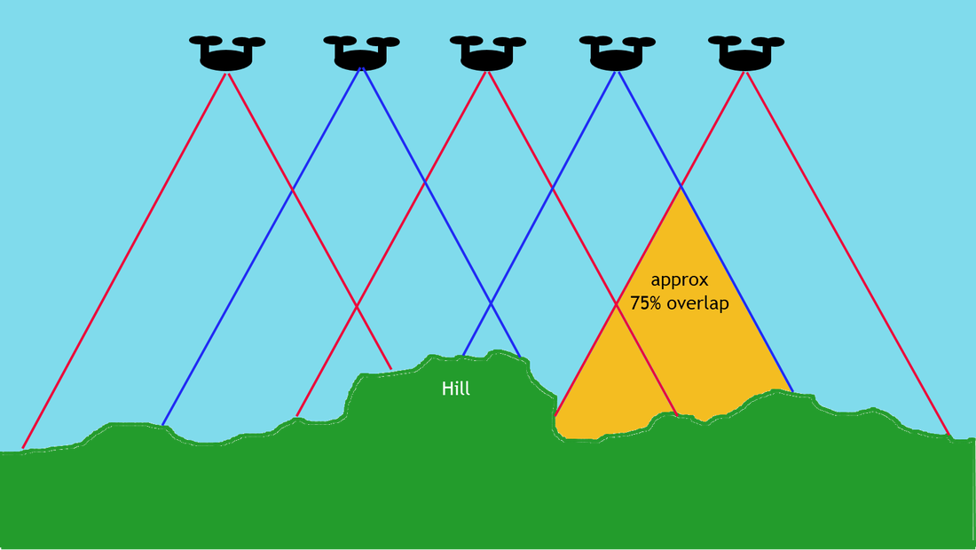
It involves taking many overlapping photographs, which allows all the major features to have multiple photos taken of it from different perspectives. This can be seen in the diagram opposite where part of the hill has part can be seen in all five drone images. Photogrammetry software findings all of the matching features and combines them to build the model. |
|
You generally need to have 75% overlap between images, front to back and side to side. With this extensive amount of overlap the software will be able to more easily notice common features and stitch the photos together in a more effective manner.
Different scanning techniques
|
Autodesk ReCap Photo is what we will be using to generate our photogrammetry. This video shows how it all works and gives some examples of some scans. The video shows what is possible in terms of levels of detail when only using photos to scan an area.
|
For instances where scanning needs to occuring in a way that requires more speed and more accuracy then rather than photos a LiDAR scan can be used. LiDAR is an acronym for Light Detection and Ranging, and involves sending out laser pulses and measruing the time they take to bounce off and return, that time is then converted to a distance. It can send out and measure over 2 million pulses per second. This scanning technology is used extensively in the underground mines.
|
Some example scans we have done
The slideshow below is some images showing scans completed by staff at the school and the quality of scans that can be achieved by relatively in expensive drones. The images are annotated with some of the issues with the scans as well. Many of these issues could have been resolved with taking more photos from different angles and with some better lighting.
Your Task
In this part of the task you are going to assume that the person you are searching for has been found using the orthomosaic scan. However in order to organise a safe and successful extraction, the resuce team wants more detailed information about the scene so that they are aware of any dangers and know the best way to approach the scene. This will be achieved by developing a 3D model and annotating this model with relevant information. This information will be added to the siutation report. Examples of some annotated images of your model are shown above
